

How a Contour and Detail Survey Informs Land Development
In the realm of land development, understanding the topography and features of a site is paramount. A contour and detail survey serves as a critical tool in this process, providing essential data that informs design, planning, and construction decisions. This article delves into the significance of contour and detail surveys, exploring how they contribute to successful land development projects.
Understanding Contour and Detail Surveys
A contour and detail survey involves the mapping of the land’s surface, capturing its elevations and the location of various features. This survey is crucial for any development project, as it provides a comprehensive view of the terrain and its characteristics.
What is a Contour Survey?
A contour survey is a graphical representation of the land’s elevation at specific intervals. The result is a series of lines, known as contour lines, which connect points of equal elevation. These lines help in visualising the slope and gradient of the land, which is vital for assessing drainage, erosion, and the overall suitability of the site for development.
By analysing the contour lines, developers can identify high and low points on the site, allowing for informed decisions regarding building placement, landscaping, and infrastructure development. This information is particularly important in areas prone to flooding or landslides, where understanding the topography can mitigate risks.
Moreover, contour surveys are not only beneficial for new developments but also for land conservation projects. By understanding the natural contours of the land, conservationists can design interventions that promote natural water flow and minimise soil erosion, thus preserving the ecological integrity of the area. The use of contour surveys in agricultural planning is also noteworthy, as farmers can optimise irrigation and crop placement based on the land’s topography, leading to better yields and sustainable practices.
What is a Detail Survey?
A detail survey complements the contour survey by providing additional information about the site. This includes the location of existing structures, vegetation, utilities, and any other significant features that may impact the development process. By capturing these details, developers gain a holistic view of the site, enabling them to plan effectively.
Detail surveys are particularly beneficial in urban environments, where existing infrastructure can complicate new developments. By understanding the layout of utilities and other features, developers can avoid costly delays and ensure compliance with local regulations.
Furthermore, detail surveys can also play a critical role in heritage conservation. When planning renovations or new constructions in historically significant areas, a detailed survey can identify protected structures and features that must be preserved. This ensures that any development respects the historical context and complies with conservation guidelines, thus maintaining the character of the neighbourhood while allowing for modernisation. Additionally, the integration of advanced technologies, such as 3D laser scanning, in detail surveys has revolutionised the precision and efficiency with which these surveys are conducted, providing even more valuable insights into the site’s existing conditions.
The Importance of Contour and Detail Surveys in Land Development
Contour and detail surveys play a vital role in various stages of land development, from initial planning to final construction. Their importance cannot be overstated, as they provide the foundational data upon which all subsequent decisions are made.
Informed Decision-Making
Having accurate data from contour and detail surveys allows developers to make informed decisions regarding site layout, building design, and resource allocation. This data-driven approach reduces the likelihood of costly mistakes and ensures that the development aligns with both environmental considerations and regulatory requirements.
For instance, understanding the slope of the land can influence the design of drainage systems, ensuring that water flows away from buildings and reduces the risk of flooding. Similarly, identifying the location of existing utilities can help in planning new infrastructure without disrupting services.
Additionally, contour surveys can reveal the natural features of the landscape, such as hills, valleys, and water bodies, which can be crucial for preserving the ecological balance of the area. Developers can use this information to create green spaces or to integrate the natural environment into their designs, promoting sustainability and enhancing the aesthetic appeal of the project. Furthermore, by considering the topography in the early stages, developers can mitigate potential environmental impacts, thus fostering a more harmonious relationship between the built environment and nature.

Cost Efficiency
Investing in a contour and detail survey upfront can lead to significant cost savings in the long run. By identifying potential issues early in the development process, such as unsuitable soil conditions or the need for additional drainage, developers can address these challenges before they escalate into expensive problems.
Moreover, accurate surveys can streamline the planning process, reducing the time spent on revisions and ensuring that projects stay on schedule. This efficiency translates into financial savings, making contour and detail surveys a wise investment for any development project.
In addition to avoiding unforeseen expenses, comprehensive surveys can also enhance the overall value of the property. By ensuring that the development is optimally positioned and designed according to the land’s natural characteristics, developers can create more desirable properties that attract buyers or tenants. This strategic approach not only maximises the use of the land but also contributes to the long-term viability of the development, making it a more attractive investment for stakeholders involved.
Applications of Contour and Detail Surveys
The applications of contour and detail surveys are vast, spanning various sectors within land development. Their versatility makes them an indispensable tool for developers, architects, and planners alike.
Residential Development
In residential development, contour and detail surveys are essential for determining the best layout for homes and amenities. By understanding the topography, developers can create designs that enhance the natural landscape while ensuring proper drainage and accessibility.
Additionally, these surveys can inform decisions regarding landscaping and outdoor spaces, helping to create aesthetically pleasing and functional environments for residents. The integration of natural features into the design can significantly enhance property value and appeal.
Commercial Development
For commercial projects, contour and detail surveys provide critical information for site selection and planning. Understanding the topography and existing features can influence decisions about building placement, parking layouts, and access routes.
Furthermore, these surveys can assist in compliance with local zoning regulations and environmental assessments, ensuring that developments meet legal requirements and community standards. This proactive approach can prevent potential legal issues down the line.
Infrastructure Projects
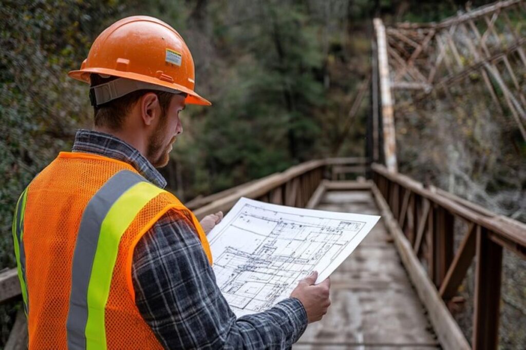
Infrastructure projects, such as roads, bridges, and utilities, heavily rely on contour and detail surveys. These surveys provide the necessary data to design safe and efficient transportation systems, ensuring that they integrate seamlessly with the surrounding landscape.
Moreover, accurate surveys can help in identifying potential environmental impacts, allowing for the implementation of mitigation strategies. This consideration is crucial in preserving natural habitats and ensuring sustainable development practices.
Technological Advancements in Surveying
The field of surveying has evolved significantly with the advent of new technologies. Modern contour and detail surveys often utilise advanced tools such as GPS, drones, and 3D modelling software, enhancing the accuracy and efficiency of the surveying process.
GPS and Drones
Global Positioning System (GPS) technology has revolutionised the way surveys are conducted. By providing precise location data, GPS allows surveyors to capture accurate elevation points quickly and efficiently. Drones, or unmanned aerial vehicles (UAVs), further enhance this capability by enabling aerial surveys of large areas in a fraction of the time it would take using traditional methods.
The use of drones also allows for the collection of high-resolution imagery, which can be used to create detailed topographical maps. This visual data can be invaluable for developers, providing a clear understanding of the site’s characteristics and potential challenges. Visit https://stoneliquidators.net/the-purpose-of-a-cadastral-survey-in-land-ownership-disputes/ to get the purpose of a cadastral survey in land ownership disputes.
3D Modelling and Visualisation
Advancements in 3D modelling software have transformed the way survey data is presented and analysed. By creating three-dimensional representations of the land, developers can visualise how their projects will interact with the existing terrain and features.
This technology allows for better collaboration among stakeholders, as it provides a clear and engaging way to communicate design concepts and potential impacts. Additionally, 3D modelling can aid in identifying potential issues early in the design process, leading to more efficient and effective solutions.
Conclusion
In conclusion, contour and detail surveys are fundamental components of successful land development. By providing accurate and comprehensive data about a site’s topography and features, these surveys enable informed decision-making, enhance cost efficiency, and support sustainable practices.
As technology continues to advance, the methods used in contour and detail surveys will only become more sophisticated, further improving their effectiveness. For developers, architects, and planners, investing in thorough surveying is not just a best practice; it is a crucial step towards ensuring the success of any land development project.
Ultimately, understanding the land’s characteristics through contour and detail surveys lays the groundwork for creating functional, sustainable, and aesthetically pleasing developments that benefit both the community and the environment.